| |
|
|
| |
|
VISITS |
|
755962 |
|
Copyright 2013
waypoints.ph |
|
|
Click on any of the images to see the enlarged copy and narratives of the photo.


Unknown to many tourists, there is a tremendous adventure experience that waits to be discovered beyond the world-famous Pagsanjan Falls. If you have visited the Pagsanjan (Magdapio) Falls (or have seen the feature here), there is a tributary found to your left when you are facing the Falls upstream. This trek destination could be named Lumot Gorge because it is connected to the Lumot River further upstream. The gorge is so deep and narrow that a GPS receiver is totally useless. Hence, the waypoint in this feature was calculated only from a map using GPS data from other points.
The trek start is at the area where the boats of Pagsanjan Falls visitors are docked. This tributary is no longer navigable for boats and the only way to see the magnificent out-of-this-world scenery inside the ravine is by hiking and swimming. The guides call that "langoy-lakad". The trek includes leaping between boulders or climbing over rocks as big as a house. That explains why this Waypoints contributor was wearing a sports helmet.
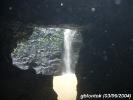
Along the ravine, there are several small but high waterfalls clouded with mist that would make you believe that there is still a part of this world at a relatively short distance from civilization barely touched by humans. At the convergence point of Caliraya River and Lumot River, the water coming down from Caliraya River forms the Caliraya Falls. But naming it Caliraya Falls could be confusing as we were told that there are other waterfalls upstream within the Caliraya River. So for this feature, this waypoint destination will be named Caliraya-Lumot Falls.
At the opposite bank of this falls, there is a cave locally known as Bat Cave. This is not your favorite superhero's secret hideout but literally the domain of thousands and thousands of bats which you would blurredly see in one of the photos.
How to get there:
Getting there is similar to the narratives described in the Pagsanjan (Magdapio) Falls feature. That means there would be substantial expenses just to get to the trek start point by boat. Beyond visiting the Pagsanjan Falls, you would need to make your boatman wait for you longer while doing the trek to Caliraya-Lumot Falls - read: "extra charges". The trek could last about an hour and a half - one way.
Tips:
We recommend hiring as guide one of the bamboo raft operators from Pagsanjan Falls as they could guide you which boulder to jump on or the particular path between boulders to pass thru. They would also gladly carry your keep-dry things over their heads while swimming.
While you are already wearing a life jacket for the boat ride, you must also rent an inner tube floatation device to help you swim safely at points of the trek where there is no place to walk on. These floatation devices are available at a minimal charge from the picnic areas downstream. Hence, you must rent one before your boat pass thru the "toll gate" during the upstream ride.
Overall, it is highly suggested that you get in touch one day in advance with the Office of the Municipality of Cavinti since this trek is not really included in the package of the "Shooting the Rapids" tour. That way, they could arrange and assign your guide. The trek area also belongs to Cavinti (as well as Pagsanjan Falls) and the raft operators are their employees.
Waypoint narrative by: GBLontok 2005 follow GBLontok on Facebook
|
|
|