| |
|
|
| |
|
VISITS |
|
755981 |
|
Copyright 2013
waypoints.ph |
|
|
Click on any of the images to see the enlarged copy and narratives of the photo.


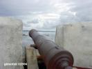
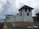
The fort or better to be called Defense and Observation Tower was made of adobe with
brick tile roof. This is the last one remaining of those built under the supervision of
the Franciscan friars in the latter part of the 19th century. This was built to help
defend the town against attacks from sea pirates.
How to get there?
I discovered that merely asking about Kutang San Diego from the locals might not lead
you to the right direction. It is because in another location, 2km before the town
proper (near km post 194), there is San Diego de Alcala Park. Having almost same name
causes confusion. Add to to that the fact that out-of-towners may have different ways
of referring to the sites: Park, Fort, Fortress, Watchtower, etc. San Diego de Alcala
Park was built on top of a big rock between the National Highway and the PNR railroad.
Being beside the highway, this park happened to be more popular and known to people
along the highway than the more historical Kutang San Diego or Fort San Diego. The
park,located at 13?56.119'N 122?05.056E elev 31m, is also worth visiting as it gives a
higher and better view of Lamon Bay, provided that the overgrowth has been properly
trimmed.
On the other hand, to find Kutang San Diego, you only need to go on and proceed to
Gumaca town proper. As you approach Gumaca, avoid getting distracted by the towering
fast food signs - you should have been tired of that as you have seen so many of them in
the 196km roadway from Manila. Watch out for the bridge a few meters after the railroad
crossing. While crossing this bridge, the Kutang San Diego may already be seen by
looking to your left toward the sea. It can be seen at the right bank of the river.
Turn left at the street after the bridge to get to the Kuta. Indeed, there is also a
park around the Kuta. In the south side of the Kuta, around the next corner is San
Diego de Alcala Parish Church, which also featured in www.waypoints.ph - identified as
Gumaca Church.Waypoint narrative by: GBLontok 2004 follow GBLontok on Facebook
|
|
|