| |
|
|
| |
|
VISITS |
|
|
|
Copyright 2013
waypoints.ph |
|
|
Click on any of the images to see the enlarged copy and narratives of the photo.
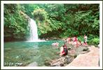

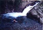

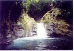
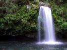
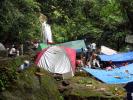
Taytay Falls, located at Barangay Gagalot, Majayjay, Laguna, has one of the
clearest flowing water we have yet seen. The water flows from Mt.
Banahaw, through the mountain's lush and untouched forest which keeps the
water clear even during heavy rains. The water temperature is VERY cold
even during summer but, for people who are not used to cold water, they can
still take a swim for a few minutes before their teeth should start to
chatter. One must hike about 15 minutes through a small path to reach
the falls. No way around this. And the hike is not for the
not-so-sure-footed either! The path is slippery at some sections and is
just a couple of feet from the almost-vertical side of the mountain.
How to get there
From Manila, you actually have 2 routes to choose from. The first route is via
the South Luzon Tollway, and the other route via the other side of Laguna de Bay through
Rizal province (known to some people as the backdoor route). We could say
that the two routes are almost the same in distance from the boundaries of
Manila. Perhaps, which route to take would depend primarily on what
part of Manila you are coming from. If you are coming from the southern
part of Manila, you could take the South Luzon Tollway route, otherwise, you can take the
Rizal province route. You may want to note however that the backdoor
route is more scenic.
Via South Luzon Tollway to Majayjay town proper
From Manila, take the South Luzon Tollway all the way from Nichols entry to the south end.
At the end of the tollway, take the exit that points to Lucena and simply drive along
this main road until you reach the Sto. Tomas. Sto. Tomas has two junctions,
and one of which (the second) does not have any road sign when we passed by.
Anyway, on both juctions, you have to take the road to the left (westward) toward
Lucena. This will take you to San Pablo, Laguna At San Pablo, head into
town (westward) and try to get to the road that goes to Liliw, Laguna on the west
side of San Pablo. You may have to ask locals at San Pablo for directions.
Once you are out of San Pablo, simply follow the road up to Rizal and then
to Nagcarlan. Just before reaching the town proper of Nagcarlan, you
may want to ask for directions to find the junction that leads to Liliw. Head
for the town of Liliw then to Majayjay.
Via backdoor route to Majayjay town proper
First objective here is to get to Antipolo. For those who are not familiar
with how to get to Antipolo, you can start from the EDSA shrine at the intersection
of EDSA and Ortigas Avenue. From the EDSA shrine, head eastward along Ortigas
Avenue straight towards the foot of the mountains of Antipolo then up to Antipolo.
At Antipolo, where the road levels off, keep on following the main road
(veering to the right on two "Y" junctions) until you begin steep descends on
the other side of the mountain. This will take you through Teresa and then to
the junction near Morong.
At the Morong Junction, turn left, then about a hundred meters from this junction,
there is a another "Y" junction. Take the left side to bypass the towns of Baras,
Tanay and Pililia. The right side will take you through each town proper where traffic
will be heavier. From this point, travel will be relatively pleasant.
there will be a marked change in scenery and quality of air! Nice flat lands
and rice fields from Morong to Pililia then a pleasant climb on well-marked
mountain roads to Bugarin with a nice view of Laguna de Bay then down to Mabitac,
Famy, Siniloan, Pakil, Paete, Lumban then Pagsanjan.
At Pagsanjan, turn right on the main road in front of the church. This
will take you through the big concrete arch marking the boundary of Pagsanjan.
Then, about 3 kilometers from the arch, you will see a junction which
will lead to Magdalena and Majayjay. Turn left on this junction.
Travel southwards to Magdalena (about 7 km). Then at Magdalena, the road
will veer to the right then there will be a junction.
Turn left towards Majayjay (the opposite turn will take you to Liliw).
Just keep following the road from this point. There is yet another
small junction very near Majayjay. The junction has street signs leading
to Majayjay, but, just in case the sign got stolen or something, just take the
left (the right will take you to Liliw).
From Majayjay town to Taytay falls
Taytay falls is still about 8++ km from Majayjay town proper. As of
travelogue time (Aug 2001) there still are no adequate street signs leading
to the site and there are no adequate landmarks either. We have
GPS coordinates of the route from Majayjay town proper to the falls.
So, for GPS users, all you need to do is to upload the coordinates to your
receivers and trek on. For those who do not have GPS receivers, I
will try to "narrate" the way as accurately as I can so you can locate the
site as well:
From Majayjay town proper, exit town eastward towards Lucban, Quezon.
About 1.5 km from town, the road will start to snake, going down to a
bridge then up again for about a kilometer until you get to a junction that
leads to Louisiana. From this junction, continue heading towards
Lucban for another 2.4 km, then watch out for a side-road on the right
side with (hopefully by now) a sign pointing to Gagalot or to the
Taytay falls. Turn right and take this side-road. The side road
is narrow but concrete! Follow the road up, and, after about 2.3 km,
there will be what you may call a jeepney terminal and a cluster of
small carinderias. Turn right then go down about 750m to Gagalot.
At the barangay, you will see signs indicating where to park your
vehicle near a small barangay hall where you would be required to
register and pay a fee of P10 per head for entrance to the falls.
Park your vehicle, register and prepare all your things as it would
be hiking from this point on. The hike would be about 15 minutes
and about 800m long. You can get all info about the place from the
people at the registration place.
Tips ...
The only facility you will find within a kilometer from the falls is
a couple of toilets. There are no stores, no electricity, no shelters.
No cellphone signals too. Bring your own whatever. Camping is allowed,
and we learned that you can even rent tents from some of the barangay residents.
Like practically all places frequented by tourists, we do not recommend
going to this place on weekends and holidays when there simply are just too
many people going to such a small place (and through such a narrow pathway!).
Waypoint narrative by: EPPGarcia 2002 follow EPPGarcia on Facebook
Additional narratives or blogs:
just want to share some things about majayjay...
it's beautiful pero its terribly crowded pag weekend. every piece of real estate, and i mean
EVERY nook, crevice, large rock, etc was turned into a campsite. There were about a
thousand people there! i didnt appreciate the bird sounds in the morning because somebody
brought a blaring karaoke...imagine hearing the hotbabes singing bulaklak in the middle of
the forest! sabagay...bulaklak nga eh...
its really sad, pero its going to be an environmental disaster soon. lahat ng uri ng basura nakakalat na dun inspite of the efforts of the local community. i guess marami lang sa atin
ang walang pakiaalam. it broke my heart to see spent corn cobs and junk food wrappers
floating in the main waterfalls basin. yung canal na dapat ay clear, flowing water...it was
full of unusual, and funny debris...from frayed sandals, to soiled underwear, meron pang
takip ng takuri, at syempre...shriek...soap suds!
if you want to camp dun on a weekend, better camp at the parking area. grassy ground and
good drainage. maluwag pa. dun sa falls....grabe! parang divisoria sa gulo. we had no
choice but to put up our tent in a downslope...it was a disaster when it rained. nightswimming ang nangyari!
its a beautiful place slowly being ruined by irreverent tourism. sayang cause ive never
quite swam in a basin of water na parang galing sa ref...ang sarap! By: Jay_J 2004
|
|
|