| |
|
|
| |
|
VISITS |
|
782936 |
|
Copyright 2001-2016
waypoints.ph |
|
|
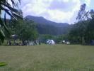
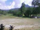
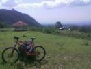
Click on any of the images to see the enlarged copy and narratives of the photo.


Nestled at the foothills of Mt. Mandalagan and Mt. Marapara is a small
village of Patag. Today the village of Patag is for nature enthusiasts and outdoor buffs. Situated at a cool elevation of nearly a couple of thousand feet above the sea. Patag is the last frontier of the Japanese Army that surrendered in Negros Island. A Historical Hospital is also in th site. The area is flat among the other hilly surrounding area, thus the illonggo word "Patag".
Part of Silay City; Some 45 kms. from Bacolod City; located 490 meters
above sea level between the highlands of Mt. Silay and Mt. Marapara, Patag has also become a War Memorial destination for the Japanese where, during the last war, some 6,000 Japanese soldiers died in the midst of its wilderness. It is believed that in this area that soldiers and people who died during WWII where buried (so basically dozens of ghost stories can be heatd from the guides and locals). This is also the jump off point of the hike going to Tinagong Dagat or Mount Mandalagan. The Waypoint coordinate is taken infront of the old Hospital (not operational). The site is also a place for Boy Scout
Jamborees and Red Cross Training.
This area is also starting point going to a waterfalls called "Pulang Tubig" because the water coming down seems to be seen as red in color. The reality was that the stones and rocks it falls unto are red or orange in color. Patag boasts of several beautiful waterfalls, a
variety of flora and fauna, and a host of other natural attractions and of home of the Philippines spotted deer.. An adventure trek to Patag is pleasantly memorable as well as a challenging physical experience and some highlights of the trek is the skylineride.
How to get there:
By Jeepney: Take a jeepney ride from Bacolod City Proper and look for
any jeepney that will have the "Silay" Sign. Arriving in Silay City Public Market, ask locals from the area where the jeepneys are parked that will take you to Patag, or if the group is big, ask the drivers if you can rent the whole jeep and make a good negotiation about it.
Using tracklogs/Waypoints: Make your way from Bacolod city and drive
through Lacson Street (also National Road), proceed North without any
turns and passing Mandalagan Area, then Talisay City, then finally
arriving in Silay City. From Silay City proper, keep moving north along the national highway and proceed to a junction on the right side (just about exiting Silay City proper) with sugarcane field all over the place and a sign indicating the road going to AIDSISA (Old
Sugarcane Milling Factory). As you approach each junction, just
continue straight down the road. You will encounter semi cemented and
rough and gravel road. as you approach the final leg before the hospital, you will be going through winding roads. You will then realize that you have reached the Jamboree marker for Patag.
Waypoint narrative by: paulperez 2004 follow paulperez on Facebook
|
|
|