| |
|
|
| |
|
VISITS |
|
755992 |
|
Copyright 2013
waypoints.ph |
|
|
Click on any of the images to see the enlarged copy and narratives of the photo.


I learned of this waterfalls from the philtravelcenter.com website. The website features several natural attractions in the province of Cavite and contained general descriptions and narrative directions on how to reach the falls. However, as with those several other natural attractions it featured, it did not have any photos of the place. So I got curious and my daughter and I decided to travel to this place.
We were somehow expecting that this falls (having been featured on an travel guide website) would be more or less a semi-developed or developed tourist spot. Little did we know, we were actually in for a "trekker's treat". The falls is very much untouched by civilization. No paved roads leading to it, no footpaths either. We had to cut our way through tall grasses to make a path and we had to scale large boulders the size of cars to reach the falls. It was one exhausting 20 minute hike, but, as trekkers and photographers, we enjoyed it immensely.
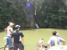
The falls reminds us of Taytay Falls in Majayjay. It has a central cascade and a fairly large pool at its foot. Difference is, Malibiclibic has a much much larger pool that it dwarfs the falls even if we estimate its cascade to be bigger than that of Taytay Falls. Access to the falls is similar, a few kilometers by vehicle from the main road and a few minutes hike to the falls. But, unlike Taytay Falls, Malibiclibic has totally no traces of man-made structures thus making it a true trekker's destination.
Waypoint narrative by: EPPGarcia 2003 follow EPPGarcia on Facebook
Additional narratives or blogs:
some friends and i went to malibiclibic falls last saturday (31May) despite the heavy rainfall. we took a bus going to alfonso, then a jeep to aguinaldo, and a tricycle to brgy. lumipa. the brgy. captain, roy loyola, escorted us to the falls.... which turned out to be a VERY difficult trek. due to the rains, the soil was slippery (did i mention VERY?), and so were the boulders. the falls and the pond (or river?), even, were'nt as
good-looking as those in waypoints.ph coz the water was brownish, again, due to the heavy
rainfall. still, we enjoyed going there and will probably go back after the rainy season.By: AGMTamayo 2003
Even while we are providing directions and GPS tracks that lead directly to this waypoint, we would like to encourage prospective trekkers to first touch base with the barangay officials of Lumipa before venturing on to the falls. The barangay people would be more than glad to escort visitors to the falls. In fact, they prefer that they do so. You can look for the following people: Roy Loyola - Barangay Captain, Joby Gloriani - Councilor, or Oscar Ilao - President of the Samahang Kabataan. Just ask around from anyone in the barrio. It's a small barrio, everyone knows everybody.By: EPPGarcia 2003
I can't imagine how AGMTamayo survived the trek to Malicbilic Falls on a rainy day... It was such a diificult but in the end a worthy trek... We went there last March 25, 2006 without any idea on the real score of the place since 2003 (the year the last narratrives were posted)... but it seems to me that nothing much changed... the place is still "untouched by civilization".... we did swim also to the large (and deep) pool just to feel the falls... with the bamboo pole as our floatation device, we reached the falls and the cave (with the green python on the wall).... A trek to the Malibiclibic Falls is indeed a trekker's treat... Thanks to Dexter Binauhan, SK President for assisting us and to waypoint for giving us places to visit... By: Angel_Juarez 2006
We went there last weekend and boy was it an ADVENTURE! The path was pretty hard, well for amateur trekkers like us, it was really tough noh! We slipped and slid, got 3rd degree sunburn on our backs, blisters on our feet and saw snakes and crocodiles (no kidding) but it was all worth it! Thanks to our guides, current SK Chairman, Dexter and his friend Benjie who painstakingly trudged along, helping us all throughout the hike.By: suzie_angeles 2006
|
|
|